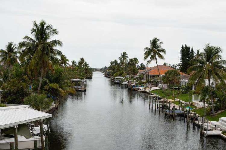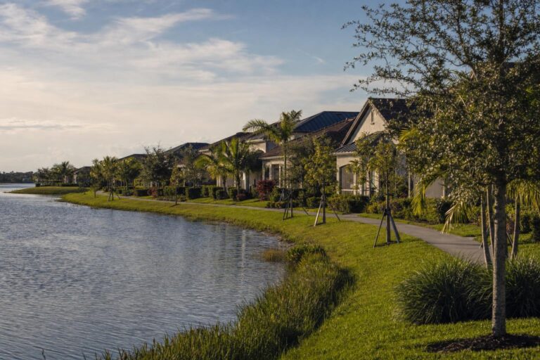

Two homes on the same Cape Coral street can sit on very different water. One backs onto a saltwater channel with a route to the Gulf, and the one across the street faces a freshwater pond-like canal that never leaves the neighborhood. Understanding Cape Coral canals before you shop saves you from paying a waterfront price for water you cannot use the way you planned.
This guide covers how the system is built, what Gulf access really means, what happened with the Chiquita Lock, and the checks to run before you make an offer.
How the Cape Coral Canal System Works
The City of Cape Coral says on its canal dredging page that it maintains 400+ miles of canals, and its boating page says the city has more than 400 miles of canals, many with direct access to the Caloosahatchee River and the Gulf of America. The dredging page adds the part many buyers miss: the system was designed for flood control and water quality, and the freshwater canals also provide irrigation storage. In other words, these are working drainage channels first and boating lanes second.
The city page describes both saltwater and freshwater canals, and notes that weirs and control structures in the freshwater canals manage water levels and store excess stormwater. For the water type and boating route behind a specific lot, ask the City of Cape Coral. If a listing gives a mileage figure, ask where it comes from.
Our Cape Coral guide places these canals in the context of the wider city and its gated neighborhoods.
Gulf Access: Saltwater Canals vs Freshwater Canals
The word “waterfront” in a listing tells you almost nothing. Sort every canal address into one of these groups before you tour it.
- Saltwater canals connect to tidal water. Boats can usually travel from them toward the Caloosahatchee River and the Gulf, subject to depth, bridge heights and the route the canal takes. They rise and fall with the tides.
- Freshwater canals sit behind weirs and control structures. Treat them as scenic, good for paddling, fishing or a small boat kept locally, but not as a route to the Gulf unless the city or a survey shows otherwise.
- Basins and larger channels may carry their own rules, so ask which one the lot touches.
Even on a saltwater canal, “Gulf access” is a route, not a guarantee. The trip can run several miles through multiple canals and past fixed bridges and slow-speed areas, and low tide limits deeper hulls in places. Ask the City of Cape Coral about navigation conditions for the canal in question. Take a boat ride, or at least study the chart, before you assume the trip takes twenty minutes.
Sailboat Access, Bridges and the Chiquita Lock
Sailboats raise the question that motorboats often avoid: the mast. A fixed bridge, a power line or a shallow stretch anywhere along the route can stop a sailboat that a shorter powerboat clears easily. Bridge clearances vary by route, so ask a marine surveyor or local captain to name every fixed bridge. Measure your vessel from the waterline to the highest fixed point, then ask the seller, a marine surveyor or a local captain to trace the exact route and name every obstruction.
What happened with the Chiquita Lock
The Chiquita Lock sat in the South Spreader Waterway. According to the City of Cape Coral, it closed to boating on April 1, 2025, so the city could remove it under the South Spreader Waterway Enhancement Project, which also includes mangrove planting and a seawall at the lock site. The city marked the removal as complete on July 25, 2025, ahead of schedule, amid a long-running debate: the city pointed to boater and manatee safety, while the Sanibel-Captiva Conservation Foundation raised concerns about nutrient flow from the canals into surrounding waters.
That status reflects July 2025 reporting plus the city’s published project description. Confirm current conditions with the City of Cape Coral before you rely on the passage for a boat purchase or a listing claim.
Seawalls: What to Inspect Before You Buy
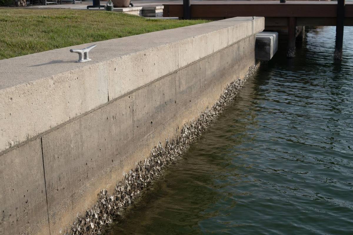
A seawall is the retaining wall at the water’s edge, and replacing one is a major project, so treat its condition as part of the purchase price. Replacement costs vary by length, material and access, so get written quotes.
- Ask for the seawall’s age and repair history, including any permit records.
- Look for signs of failure: sinkholes or soft ground behind the wall, cracked caps, leaning panels, gaps between panels and soil washing out.
- Hire a marine contractor or engineer to inspect it, including the portion below the waterline. A general home inspector may not cover it.
- Check who owns the maintenance duty. On a single-family lot it is usually the owner. In a community with a master association, the documents may assign it differently.
Seawall work and new docks require permits. The city’s Permit Document Center posts guidelines for seawall repair and replacement, docks and boat lifts.

Boat Lifts, Docks, Permits and a Pre-Offer Checklist
Do not assume an existing lift or dock is legal or insurable. Ask the seller for permit records and the final inspection sign-off, and have the lift’s capacity and condition checked. The city’s Permit Document Center lists boat lift and dock guidelines, and its application packets generally call for a site plan and lift engineering. Some projects also need state or federal approval before construction starts, so ask the city which agencies apply to your lot. Allow time for those approvals when you plan a new dock, and never start work first.
Also ask whether the lot allows the size of vessel you own. Canal width, local rules and the association’s documents, if any, can limit length or the number of boats. Before you make an offer on any canal home, work through this short list:
- Confirm saltwater or freshwater with the city, and trace the boat route to open water.
- Measure your vessel against every bridge and shallow spot on that route.
- Commission a marine inspection of the seawall, dock and lift.
- Request permit records for every structure over the water.
- Check flood zone, evacuation zone and insurance quotes for the address.
- Review any association documents for boat, dock and seawall rules.
Manatees, Speed Zones and Boating Rules
The Florida Fish and Wildlife Conservation Commission (FWC) adopts manatee protection zones that restrict vessel speed and operation where needed to prevent collisions and harassment. Local governments can set zones through ordinances, but FWC must approve them before they take effect. FWC publishes maps of the zones, and the rules sit in Chapter 68C-22 of the Florida Administrative Code. Check the maps for the zones along your route, because the speed limit on a canal can change within a short distance.
If your commute to the Gulf crosses slow zones, add that time to your estimate. Our boating and paddling guide covers where to get on the water in Southwest Florida.
Gated Marina Communities in Cape Coral
If a shared marina appeals more than private dock maintenance, two Cape Coral guides on this site document marina features. Tarpon Point is a gated community with a full-service marina that our record lists at more than 200 slips, and its Marina Village of shops and dining is open to the public. Cape Harbour is a gated community with a Gulf-access full-service marina and a public Marina Village. The marina itself is operated separately from the community association. Both listings say to confirm current amenities with the association. Lee County data lists both communities in evacuation zone A, so check the zone and insurance for any home you consider.
Neither record describes slip pricing, availability or membership terms, so ask the marina and the association directly.
Frequently Asked Questions
Can I tell from a listing whether a canal is saltwater or freshwater?+
Not reliably. Listings use “waterfront” and “Gulf access” loosely. Confirm the water type and the boating route with the city and a survey of the actual canal.
Does a canal home need flood insurance?+
Many canal homes sit in mapped flood zones, and lenders may require coverage. Check the address on FEMA’s flood map and request quotes before you make an offer.
Who maintains the canals?+
The city maintains the canal system and has been advancing a citywide dredging program, according to its stormwater page. The seawall behind your property is generally the owner’s responsibility unless an association owns it.
Visit our Cape Coral community guides to see which waterfront neighborhoods fit your boat, then verify each canal’s route and seawall in person before you sign.
Contractor directory
Find pros who already work behind your gate.
Browse contractors by trade and community, with license checks noted on each listing.
Rules and fees vary by community. Check your own governing documents and county sources before you rely on any article. Spot something out of date? Report a correction.