
Cape Coral looks simple on a map: a long grid of streets and canals between the Caloosahatchee River and Matlacha Pass. Living there has more layers than the grid suggests. If you are moving to Cape Coral, a few local facts will shape your budget and your home search more than anything in a listing, from water access to utility assessments to storm zones. This guide covers those facts and how gated communities fit in.
How Cape Coral Is Laid Out
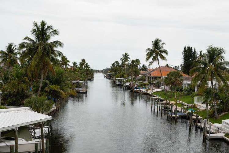
Much of Cape Coral is a repeating pattern of residential lots, and a large share of them back onto canals. The city’s canal dredging page describes “400+ miles of canals” under city maintenance.
That grid creates three kinds of homesites:
- Saltwater canal lots, some with a route to open water and some blocked by bridges or locks.
- Freshwater canal lots, which offer a water view and sometimes small-boat use, but no route to the Gulf.
- Dry lots, with no canal at all. These avoid seawall and dock upkeep.
Most Cape Coral homes sit on ordinary city streets rather than behind a gate. Our Cape Coral guides cover eight gated communities, and they range from marina towers to inland lake neighborhoods.
Canal Homes vs Dry Lots
A canal lot is the reason many people move to Cape Coral, but it brings costs and questions a dry lot does not. Ask about each of these before you fall for the view:
- Route to open water. Find out how many bridges sit between the dock and open water, and what clearance they leave for your boat.
- Seawall age and condition. Seawall repair is generally the property owner’s responsibility and can be a major expense, so confirm the rules with the city. Ask for any inspection or permit history.
- Canal depth. The city notes that sediment and erosion reduce canal depth over time, and it is working through permits for a citywide dredging program. Depth at your dock affects what you can keep there.
- Dock and lift permits. Docks, lifts and seawalls need permits, so ask whether existing structures were permitted.
Our companion article on Cape Coral canals explains saltwater, freshwater and Gulf access in more detail.

Utility Extension Assessments
This is the cost that surprises newcomers most. Parts of Cape Coral still run on private wells and septic tanks, and the city has been extending water, sewer and irrigation lines area by area through its Utilities Extension Project, or UEP. Owners in each new area pay an assessment for the lines.
The city says it has extended utilities to “nearly all of Cape Coral south of Pine Island Road” and is now working north. As of October 11, 2026, the city’s UEP pages list these areas still in progress:
- North 1 West: construction contractors have reached substantial completion, and connection notices have gone out to residents.
- North 1 East: part of the North 1 project, which covers about 4.3 square miles in the northeast quadrant, generally bounded by Santa Barbara and Andalusia Boulevards on the west, Northeast 24th Avenue, Diplomat Parkway and Corbett Road on the east, and Northeast 28th Street on the north. The city began issuing notices to proceed to contractors in December 2025 and expects construction to finish by the end of 2027.
- North 3: in design.
- North 5 and North 6: in study.
The amounts are large. For North 1 East, the city’s cost page lists a land area assessment of $25,538 for a standard 10,000-square-foot parcel, plus a capital facility expansion charge of $6,750, for $32,288 in total. Owners who did not prepay are billed on the annual tax bill over 20, 25 or 30 years, with 30 years as the default, according to the city’s financing page. Connecting the house to the new lines is a separate plumbing cost.
If a home you like is north of Pine Island Road, ask whether it has city water and sewer, whether an assessment is still owed, and how much of it transfers with the sale. The city’s Utilities Extension Project page links to each area’s details.
Storms, Flood Zones and Evacuation
Cape Coral sits low and close to the water, so storm planning is part of owning a home here. Two separate maps apply to every address.
The flood zone comes from FEMA and drives flood insurance and building rules. The city runs its own floodplain program, so use its flood information portal rather than the county’s map. The evacuation zone comes from Lee County Emergency Management and tells you when to leave before a storm.
Gated communities show how much these vary. Our guides list Tarpon Point, on the southwest waterfront, in evacuation zone A with most mapped features in flood zone VE. Sandoval, an inland lake community in the northwest, sits in zones A and B. Coral Lakes and Bella Vida in the northeast sit in zone D. Those readings come from Lee County data checked August 28, 2026.
Check both zones for any address, and get insurance quotes for wind and flood before you commit to a price.

Choosing a Gated Community in Cape Coral
The eight communities in our guides fall into a few groups:
- Waterfront and marina communities, such as Tarpon Point and Cape Harbour on the southwest shoreline. Both pair gated homes and condo towers with a public marina village.
- Inland lake communities, such as Sandoval, which is built around twenty lakes with no boating route to the Gulf.
- Newer northeast neighborhoods, such as Village at Entrada, Coral Lakes and Bella Vida. Coral Lakes and Bella Vida each carry a community development district assessment on the tax bill.
- A golf community outside the city limits. Cape Royal sits in unincorporated Lee County toward Matlacha. Its golf club sells memberships separately from the home.
Two practical notes help when you compare them. At Tarpon Point and Cape Harbour, the marina village with its shops and restaurants is open to the public, while the residential sections sit behind the gate, so expect visitor traffic near the water. And Isles of Porto Vista, inside the Entrada area, is a condominium enclave of about 144 units with its own association, separate from Village at Entrada, even though listings may use the Entrada name for both.
Jurisdiction matters for taxes. Most of these communities pay the City of Cape Coral rate, which totaled 15.3806 mills in Lee County’s 2025 millage book. Cape Royal’s main taxing district totaled 14.6625 mills. Those totals exclude non-ad valorem assessments, such as CDD charges.
Your First Months After Moving to Cape Coral
Once you close, a few tasks have deadlines. If the home is your permanent residence as of January 1, file for the homestead exemption with the Lee County Property Appraiser by March 1. Update your driver license, vehicle registration and voter record. Set up utilities, and if your home is on a well, ask about water testing and the irrigation rules for your area.
Also learn your garbage and recycling days and your hurricane plan before June. Our resources page collects these local basics in one place.
This is general information. Confirm assessments, flood zones and tax figures with the City of Cape Coral, Lee County offices and a licensed insurance agent for any home you consider.
Frequently Asked Questions
Does every Cape Coral home have city water and sewer?+
No. The city has extended utilities to nearly all of Cape Coral south of Pine Island Road, but several northern areas are still in construction, design or study. Ask about utility status and any unpaid assessment for any northern address.
Is a freshwater canal lot worth it?+
It depends on what you want. A freshwater canal gives a water view and often small-boat use, but no route to the Gulf. If boating offshore is your goal, look at saltwater lots and check the bridges along the route.
Are there gated golf communities in Cape Coral?+
Cape Royal is the one in our guides, and it sits just outside the city limits in unincorporated Lee County. Golf membership there is optional and sold separately from the home.
Visit our community guides to compare Cape Coral neighborhoods by flood zone, evacuation zone and costs before you schedule showings.
Contractor directory
Find pros who already work behind your gate.
Browse contractors by trade and community, with license checks noted on each listing.
Rules and fees vary by community. Check your own governing documents and county sources before you rely on any article. Spot something out of date? Report a correction.